* While normal to above-normal rainfall is expected over much of Northern Region — Department of Climate Change & Meteorological Services Climate
By Duncan Mlanjira
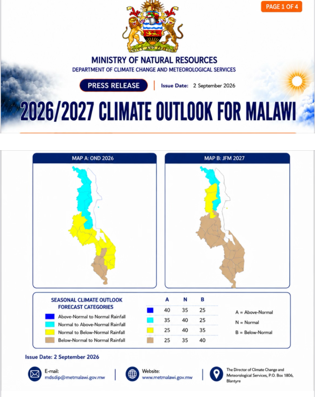
The Department of Climate Change & Meteorological Services Climate (DCCMS) forecasts that the 2026/2027 rainfall outlook for October-November-December (OND), indicates high chance of below-normal rainfall over most areas of Southern and Central Regions — while normal to above-normal rainfall is expected over much of North (Map 1 above).
In its 2026/2027 Climate Outlook for Malawi issued today, September 2, the January-February-March (JFM) expects below-normal rainfall over Southern and Central regions, while normal to above-normal rainfall is likely over most of the North — except Mzimba and parts of Rumphi, where normal to below-normal rainfall is likely as indicated in Map B.

Advertisement
Rainfall onset
The DCCMS reports that the rainfall onset is expected to be significantly delayed over the South, slightly delayed over the Centre, and normal over the North.
Overall, established rainfall onset is expected from mid-December over the majority of the country.
Rainfall cessation
Normal cessation is expected over most areas. Rains are likely to tail off during the last week of March over the Southern areas, the first week of April over the Centre, and the second week of April over most of the North
Length of season
The season is expected to last between 100 and 120 days over most southern and central areas, and between 110 and 140 days over most northern areas.
Temperature
Warmer-than-normal temperatures are expected during the upcoming season, increasing the likelihood of heatwaves.
On the its impacts, the DCCMS indicates that the 2026/2027 rainfall season is expected to be drier and more variable, particularly over the
South and the Centre, “with a higher likelihood of delayed and erratic onset and prolonged dry spells”.
“These conditions may result in a shorter effective growing season, reduced soil moisture and water availability, and increased risk of poor crop establishment.
“Coupled with intense heat that accelerates water loss, agricultural output wil likely suffer, and maize production may significantly reduce compared to last season if mitigation measures are not put in place.”

Lake Malawi
The DCCMS further notifies the public, especially those on the lakeshore areas that water levels on Lake Malawi are expected to recede by 0.2 to 0.3 metres.
The Northern Region is expected to experience “comparatively wetter conditions, although periods of above-normal rainfall may increase the risk of waterlogging, flooding, and soil erosion in some areas”.
“In summary, the expected rainfall variability, delayed onset, and prolonged dry spells signal the need for early preparedness and timely climate-informed decisions, particularly in southern and central Malawi.”
Major atmospheric systems that influence rainfall in Malawi
The main atmospheric systems influencing rainfall in Malawi include the Inter-Tropical Convergence Zone (ITCZ), the Congo air mass, easterly waves, and tropical cyclones.
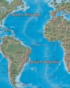
The activity and intensity of these systems are influenced by large-scale atmospheric and oceanic conditions, including mean sea-level pressure, upper-level wind patterns, and sea-surface temperatures across the tropical Pacific, Indian, and Atlantic Oceans.
On the El Niño Southern Oscillation (ENSO) projection, the DCCMS reports that as of August 2026, observations indicate that the El Niño has already developed.
“Most global climate models indicate a high chance (over 90%) that a strong El Niño will develop and persist throughout the rainfall season.
“El Niño is characterised by the unusual warming of waters in the eastern-central equatorial Pacific Ocean and typically results in below-average rainfall in Southern Africa, including southern Malawi.
“Historically, strong El Niño events similar to the current season occurred in 1982/1983, 1997/1998, 2015/2016, and 2023/2024.”
In mid July 2026, the DCCMS alerted the public of strong-to-very-strong El Niño event developing over the tropical Pacific Ocean, which is likely to persist into 2027 and assured it will keep monitoring its developments.

Advertisement
Application of the forecast
The DCCMS states that this forecast “is applicable for relatively large areas and seasonal timescales and may, therefore, not capture all factors contributing to localised climate variability, including daily and weekly fluctuations.
“To address these variations at the local and monthly scales, DCCMS has developed downscaled district-level forecasts.
“In addition, daily, five-day, weekly and 10-day forecasts, agrometeorological bulletins, and seasonal updates will be issued throughout the season.
“DCCMS will also provide timely warnings and advisories on potential extreme weather events that may occur during the season.
Sub-season probabilistic forecast: OND and JFM
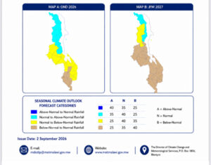
Below are the forecast maps for the 2026/2027 rainfall outlook, covering the period October to December (OND) 2026 and January to March (JFM) 2027, presented as probabilities of occurrence of rainfall amounts.
Map A – OND 2026
A yellow colour dominates most parts of southern and central Malawi, indicating a higher likelihood of rainfall in the normal to below-normal categories.
The risk of below-normal rainfall is high in the Shire Valley, Thyolo, Blantyre, Mwanza, Neno, and Balaka. In most areas of the North — however, there is a higher likelihood of rainfall in the normal to above-normal category.
Map B — JFM 2027
A brown colour dominates the southern and central areas, indicating a high chance that rainfall will fall in the below-normal category — implying a high risk of dry spells and drought.
Normal to below-normal rainfall is likely over some parts of northern Malawi, though districts such as Chitipa, Karonga, Nkhata Bay, and parts of Rumphi may receive rainfall in the normal to above-normal category.
Supporting climate date: regional comparison
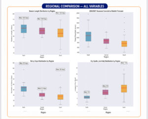
The chart above summarises the rainfall-season variables by region — season length, total rainfall, number of rainy days, and dry spells during January-February — providing additional context for the 2026/2027 outlook.
This regional comparison shows how the North, Centre, and South differ in four key rainfall-season variables: season length, total rainfall, number of rainy days, and January-February dry spells. Use this information alongside the outlook to guide planning and decision-making.